Overview
Operator: Jake Barbieur (N9DMT)
Entity: US-4491 – Superior National Forest
Dates: June 21–25, 2025
Trip Type: Multi-day canoe trip with POTA activations
Group: Jake, Andy, Megan, Mike
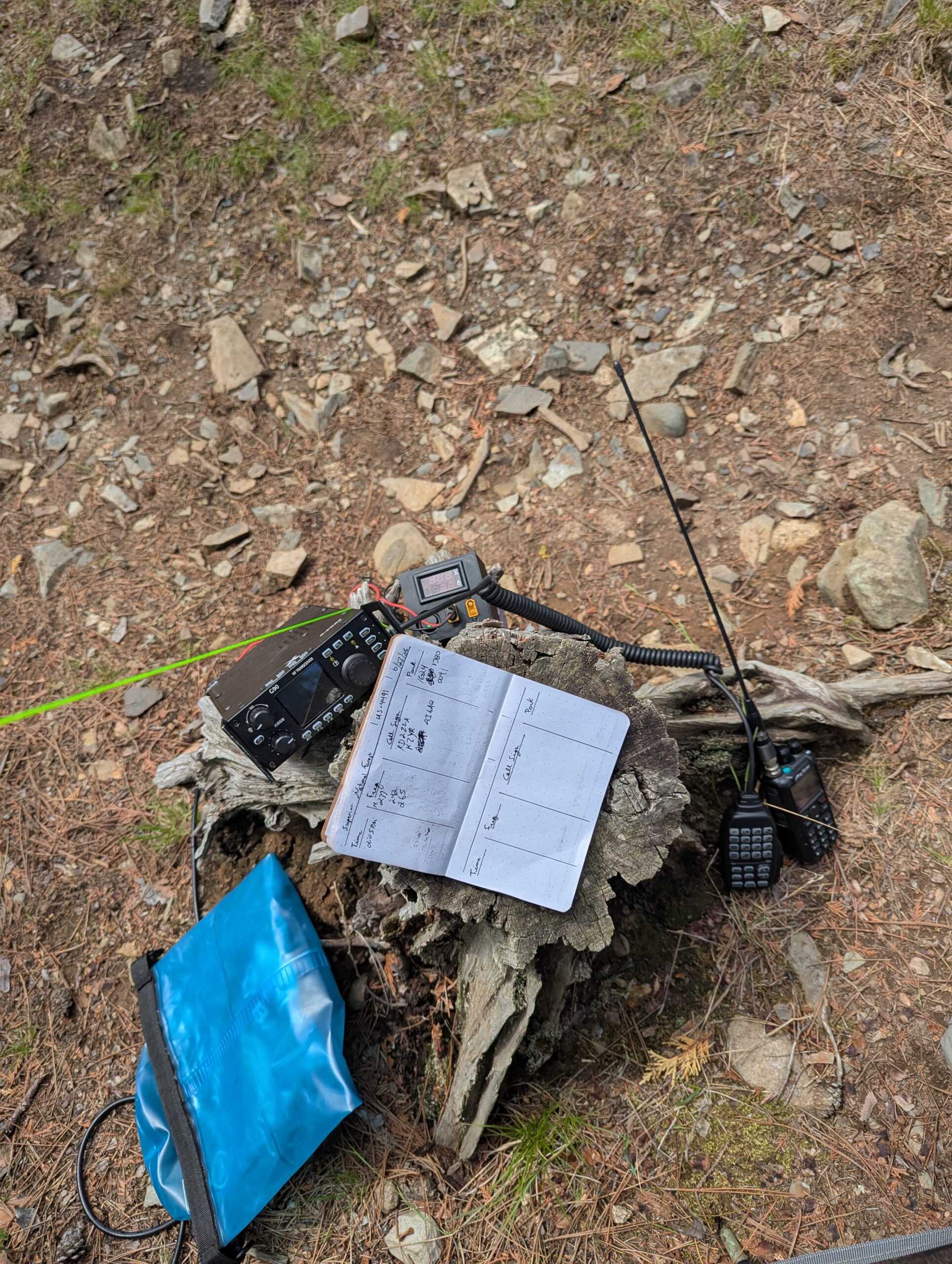
Radio Equipment
| Item | Details |
|---|---|
| Radio | Xiegu G90 (20W) |
| Power | 6Ah Bioenno LiFePO₄ + folding solar panel |
| Antennas | 20m dipole and 20m EFHW (homebrew) |
| Accessories | Extra coax, throw line, dry bag |
| Bands Used | 20 meters only |
| QSOs | 24 HF contacts, 1 VHF repeater contact |
Notes:
- RG8X coax was selected over the usual RG-174 despite the weight penalty due to its increased durability. I’ve previously had issues with RG-174 getting damaged on these trips and didn’t want to take the risk. Both cables were made with one PL-259 and one BNC end.
- The antennas used were this EFHW and this 20m dipole with this balun swapped in.
- All radio gear was carried in a single 20L dry bag inside a 70L dry pack and accounted for ~30% of total pack weight.
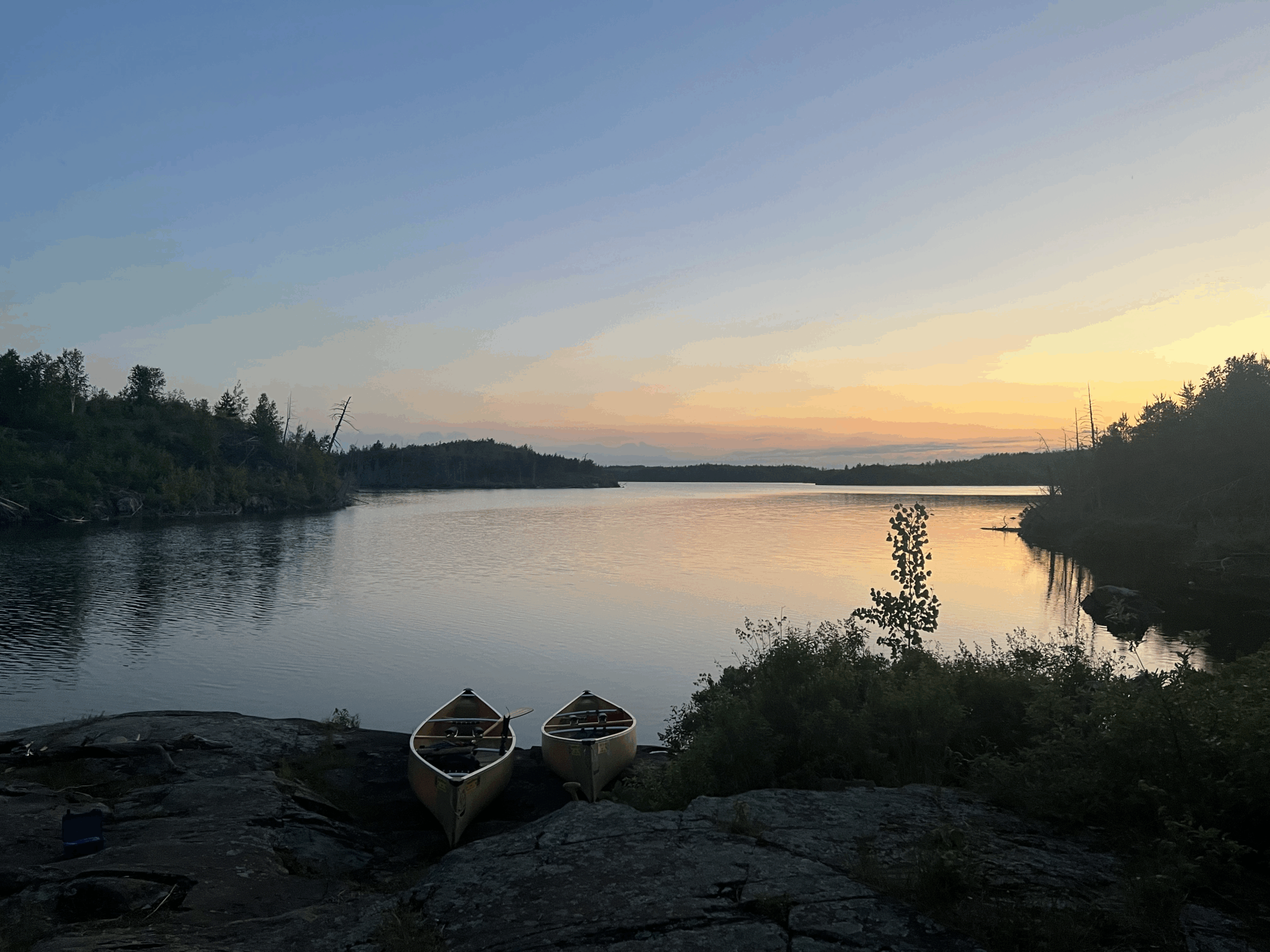
Day 1 – Jasper Lake
Location: 48.114035°N, 91.005471°W
Camp Rating: 2.5/5
We paddled through Seagull, Alpine, and into Jasper. Set up camp with plenty of bugs and limited space. While preparing dinner, one group member cut their finger deeply—almost a trip-ender. We used 2 rounds of Celox to clot the wound which healed well over the following days.
Radio:
Made a VHF contact to KF8AIF via the Gunflint repeater (maintained by the BWARC) using an Anytone 878UVII Plus. No HF from this site – too tired from hours of car/canoe travel.
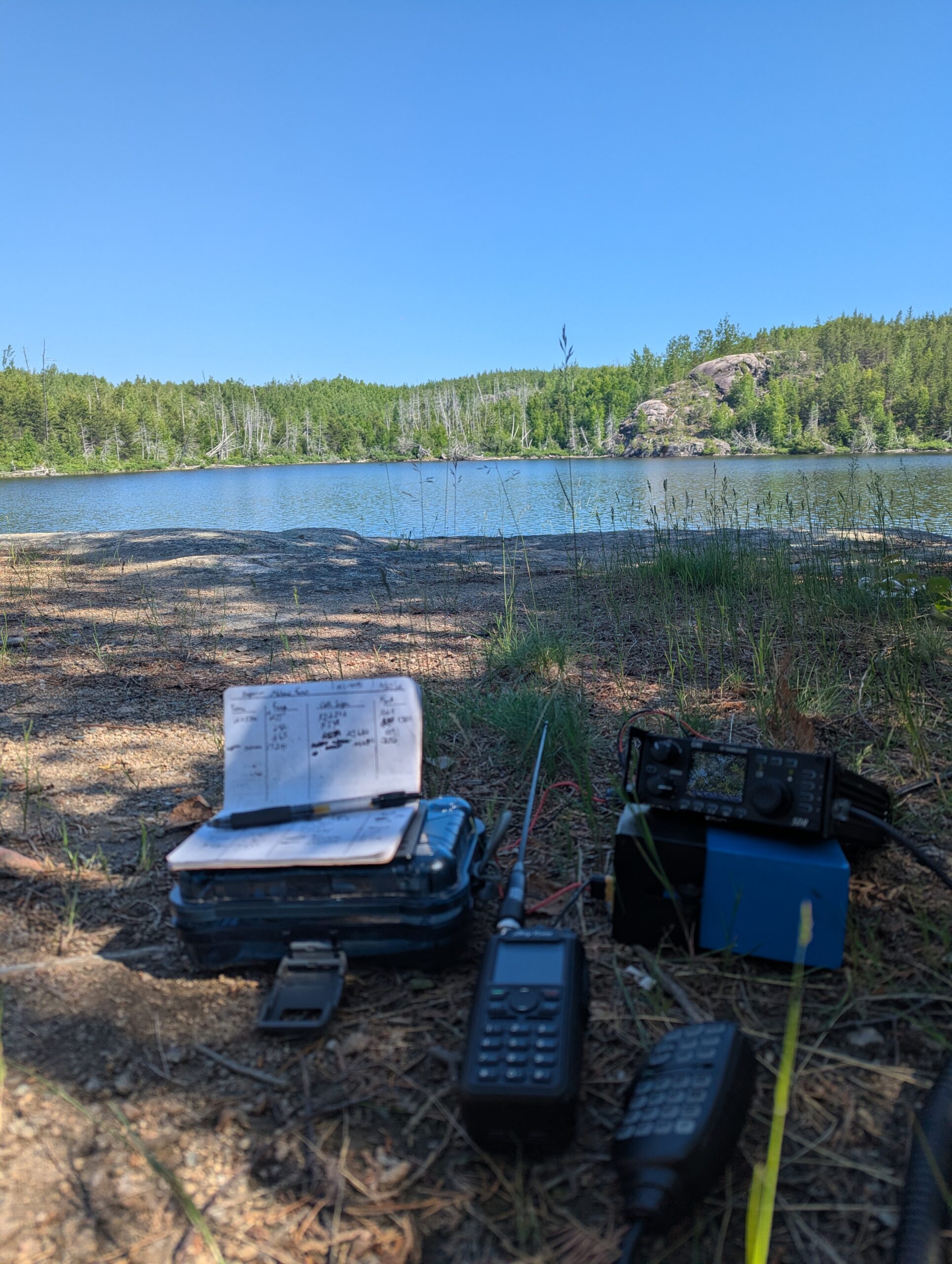
Days 2–3 – Ogishkemuncie Lake
Location: 48.091956°N, 91.064326°W
Camp Rating: 3/5
Paddled through Jasper and Kingfisher to reach Ogishkemuncie. Stayed two nights. Good fishing—Mike caught three bass and a northern—and a nice swimming spot. High canoe traffic, steep landing, and lots of bugs kept it from ranking higher.
Radio:
- 6/22: Set up a 20m dipole and managed 10 contacts to activate the park. Poor signal reports.
- 6/23: Rehung the antenna 10 feet higher. Made 4 more contacts, still with weak reports.
- Operating conditions were likely impacted by surrounding granite terrain, which always provides a unique challenge to operating in the BWCA.
Day 4 – Alpine Lake (Island Site)
Location: 48.127863°N, 90.983606°W
Camp Rating: 4/5
On the return route, we stopped at a familiar island site on Alpine. Great spot overall, but swimming was off the table thanks to a large snapping turtle circling just offshore.
Radio:
Switched to a homemade EFHW strung in an inverted-V (~20 ft apex, ~6 ft feedpoint). Made 10 contacts, slightly better signal reports than the dipole, but band conditions still weren’t great.
General Notes
- HF Conditions: 20m was the only band with usable propagation all trip. Other bands were attempted but not productive.
- Granite Bedrock: Common throughout the Boundary Waters, likely contributed to weaker HF performance.
- Power: Solar panel kept the Bioenno battery, Anytone 878UVII, and other miscellaneous electronics charged for the duration of the trip.
- Wildlife: Lots of loons, one persistent snapping turtle, and constant mosquitoes.
The trip combined backcountry paddling with two solid POTA activations and one attempt in US‑4491. Though HF conditions weren’t ideal, 25 total contacts were made (24 for POTA) from three different campsites using portable gear and simple antennas. The combination of radio and wilderness worked well, and this route is worth repeating — with a tall mast.
73 de N9DMT